
Table of Contents
GENERAL INTRODUCTION OF TELANGANA
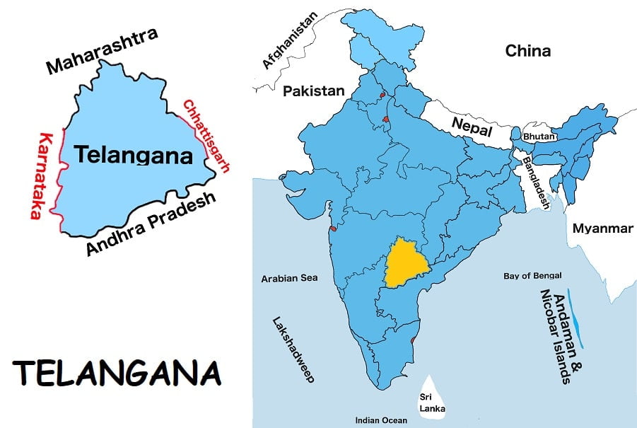
Telangana is situated in India’s southern region. It is one of the twenty-eight states of India. It is the eleventh largest Indian state by land and the twelfth most populous state in India. It shares borders with Maharashtra to the north, Chhattisgarh and Odisha to the northeast, Karnataka to the west, Andhra Pradesh to the east and south.
The Godavari and the Krishna River are two major rivers of the state and also minor rivers such as the Bhima, the Maner, the Manjira and the Musi. Hyderabad is the capital of the state.
The most widely spoken language is Telugu in the state. Urdu is the second official language of the state. Telangana’s economy is mainly driven by agriculture. The major food crop is rice and other important crops are cotton, sugar cane, mango, and tobacco.
At present, K. Chandrashekar Rao is the Chief Minister of the state.
Telangana Map
Below the table shown are basic information about Telangana.
Capital | Hyderabad |
Governor | Tamilisai Soundararajan |
Chief Minister | K. Chandrashekar Rao |
Area | 114,840 sq. km |
Population | 35,192,975 (2011 census) |
Density | 310/ sq. km (2011census) |
Literacy rate | 66.5% (2011 census) |
Official language | Telugu |
No. of districts | 33 |
Legislature | Bicameral |
Assembly seats | 119 |
Council seats | 40 |
Lok Sabha seats | 17 |
Rajya Sabha seats | 7 |
Hight Court | Telangana High Court |
High Court location | Hyderabad |
No. of border shares states | 5 |
Mammal | Spotted Deer |
Bird | Indian Roller |
Flower | Senna auriculata |
Tree | Prosopis Cineraria |
State Day |
FOR MORE INFORMATION ABOUT STATIC GK