
Table of Contents
GENERAL INTRODUCTION OF MIZORAM
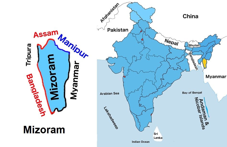
Mizoram is situated in India’s northeastern region. It is one of the twenty-eight states of India. It is the twenty-four largest State by land and the twenty-seven most populous state in India. It shares borders with Assam and Manipur to the north and Tripura to the west. It also shares international borders with Bangladesh to the west and Myanmar to the east.
It is one of the Seven Sister States of the northeast. Aizawl is the capital of the state. It is a place with flora and fauna, a rich landscape and a pleasant climate. Mizorαm is one of the leading producers of bamboo in India. The state has two National Parks and six wildlife Sanctuaries. Mizorαm has many traditional dances, such as Cheraw, Khuallam, Chheih Lam and Chai.
Chhimtuipui is the largest river in Mizoram. Chhimtuipui is also known as Kaladan (or Kolodyne). Palak Lake is the biggest in the state.
At present, Zoramthanga is the Chief Minister of the state.
Mizoram Map
Below the table shown are basic information about Mizoram.
Capital | Aizawl |
Governor | Kambhampati Hari Babu |
Chief Minister | Zoramthanga |
Area | 21,081 sq. km |
Population | 1,091,014 (2011 census) |
Density | 52/sq. km (2011 census) |
Literacy rate | 91.57% (2011 census) |
Official language | Mizo and English |
No. of districts | 11 |
Legislature | Unicameral |
Assembly seats | 40 |
Lok Sabha seats | 1 |
Rajya Sabha seats | 1 |
Hight Court | Gauhati High Court Aizawl Bench |
High Court location | Aizawl |
No. of border shares states | 3 |
Mammal | Himalayan Serow |
Flower | Red Vanda |
Tree | Indian rose chestnut |
State Day |
FOR MORE INFORMATION ABOUT STATIC GK