
Table of Contents
GENERAL INTRODUCTION OF HIMACHAL PRADESH
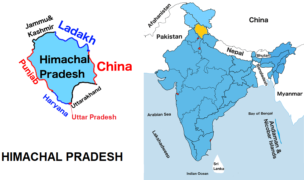
Himachal Pradesh is one of the twenty-eight states of India. It is the seventeen largest State by land and the twenty most populous state in India. It is situated in the northern part of India. Himachal Pradesh shares borders with Uttar Pradesh to the south, Uttarakhand to the southeast, Haryana to the southwest, Punjab to the west, and the Union territories Jammu and Kashmir and Ladakh to the north. It also shares international borders with the Tibet Autonomous Region of China to the north.
Himachal Pradesh is also known as Dev Bhoomi because of the occurrence of a large number of historical temples in the state. Agriculture, hydropower and tourism are key sectors of Himαchal Pradesh economics. The famous Sangla Valley is situated in the Himαchal Pradesh. The capital of Himαchal Pradesh is the leading town and the centre of education.
Himachal Pradesh Map
Below the table shown are basic information about Himαchal Pradesh.
| Capital | Shimla |
| Governor | Rajendra Vishwanath Arlekar |
| Chief Minister | Jai Ram Thakur |
| Area | 55,673 sq.km |
| Population | 6,859,509 (2011 census) |
| Density | 123/sq. km (2011 census) |
| Literacy rate | 83.78% (2011 census) |
| Official language | Hindi |
| No. of districts | 12 |
| Legislature | Unicameral |
| Assembly seats | 68 |
| Lok Sabha seats | 4 |
| Rajya Sabha seats | 3 |
| High Court | Himαchal Pradesh High Court |
| High Court location | Shimla |
| No. of border shares states | 4 + 2 (Union territories) |
| Mammal | Snow leopard |
| Bird | Western tragopan |
| Fish | Golden Mahseer |
| Flower | Bell Rhododendron |
| Fruit | Apple |
| Tree | Deodar cedar |
| State Day | April 15 |
FOR MORE INFORMATION ABOUT STATIC GK