
Table of Contents
GENERAL INTRODUCTION OF TRIPURA
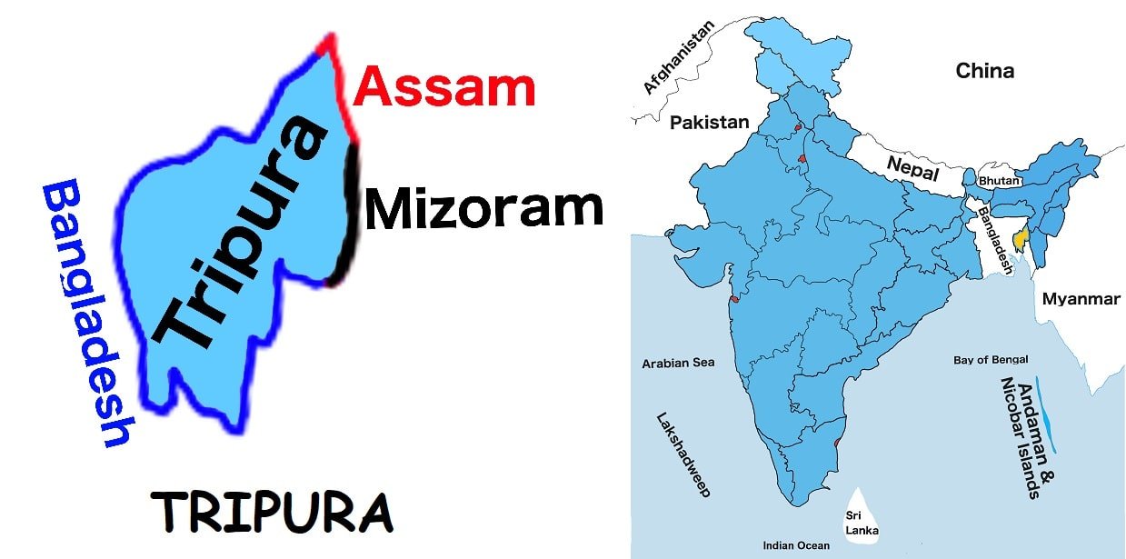
Tripura is situated in India’s northeastern region. It is one of the twenty-eight states of India. It is the third smallest Indian state by land and the twenty-one most populous state in India. It shares borders with Assam to the northeast, and Mizoram to the east. It is encircled almost on three sides by Bangladesh to the west, north, and south.
Agartala is the capital of the state. Only one major highway, the National Highway 8, connects Tripura with the rest of the country. It is one of the Seven Sister States.
More than half of the population of the state is dependent on agriculture and its allied activities. The major crop of the state is rice and other crops are potato, sugarcane, mesta, pulses and jute. Jackfruit and pineapple are the top list of horticultural products.
At present, Biplab Kumar Deb is the Chief Minister of the state.
Tripura Map
Below the table shown are basic information about Tripura.
Capital | Agartala |
Governor | Satyadev Narayan Arya |
Chief Minister | Biplab Kumar Deb |
Area | 10, 491.69 sq. km |
Population | 3,671,031 (2011 census) |
Density | 350/ sq. km (2011 census) |
Literacy rate | 87.75% (2011 census) |
Official language | Kokborok, English and Bengali |
No. of districts | 8 |
Legislature | Unicameral |
Assembly seats | 60 |
Lok Sabha seats | 2 |
Rajya Sabha seats | 1 |
Hight Court | High Court of Tripura |
High Court location | Agartala |
No. of border shares states | 2 |
Mammal | Langur |
Bird | Green Imperial Pigeon |
Flower | Nageswar |
Fruit | Pineapple |
State Day |
FOR MORE INFORMATION ABOUT STATIC GK