
Table of Contents
GENERAL INTRODUCTION ARUNACHAL PRADESH
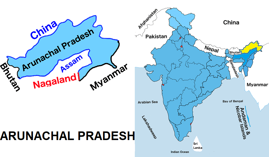
Arunachal Pradesh is one of the twenty-eight states of India. It is the fourteen largest state by land and the twenty- sixth most populous state in India. It is situated in India’s northeast region. Arunachal Pradesh shares borders with Assam and Nagaland to the south in the Indian states. It also shares international borders with Bhutan to the west, Myanmar to the east, and a disputed border with China to the north at the McMahon Line.
It is the largest of the Seven Sister States of Northeast India by area. It shares a 1,126-km border with China’s Tibet Autonomous Region. The population of Arunachal Pradesh is mostly tribal. The principal tribe of the state is Adi, Adi-abhor, Padma, Mishmi , Wancho, Nocte, Monpa, and others.
It was formed from the North-East Frontier Agency (NEFA) region and became a full state on 20 February 1987.The capital of Arunachal Pradesh is Itanagar.
ARUNACHAL MAP
Below the table shown are basic information about Arunachαl Pradesh.
Capital | Itanagar |
Governor | B. D. Mishra (Retd.) |
Chief Minister | Pema Khandu |
Area | 83,743 sq.km |
Population | 13.82 Lakh (2011 census) |
Density | 17/ sq. km (2011 census) |
Literacy Rate | 66.95% (2011 census) |
Official languages | English |
No. of districts | 25 |
Legislature | Unicameral |
Assembly seats | 60 |
Lok Sabha seats | 2 |
Rajya Sabha seat | 1 |
High Court | High Court of Guwahati |
High Court location | Itanagar Bench |
No. of border shares states | 2 |
Mammal | Gayal (Mithun) |
Bird | Hornbill |
Fish | Golden Mahseer |
Flower | Foxtail orchid |
Tee | |
State Day | February 20 |