
Table of Contents
GENERAL INTRODUCTION OF JHARKHAND
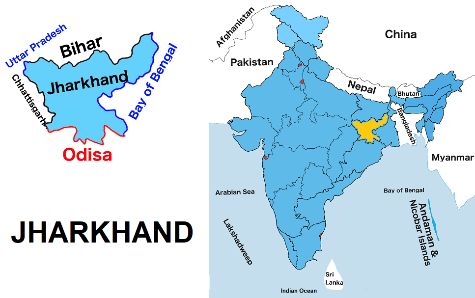
It is situated in India’s eastern region. It is one of the twenty-eight states of India. It is the fifteen largest State by land and the fourteen most populous state in India. It shares borders with Uttar Pradesh to the northwest, West Bengal to the east, Bihar to the north, Chhattisgarh to the west, and Odisha to the south.
Jhαrkhand is rich in mineral resources such as iron ore, coal, limestone, graphite, dolomite etc. Kodarma district of Jharkhand is known as the ‘Mica capital of India’. In Jamshedpur, Tata Iron and Steel Company (TISCO), the oldest steel plant in the country, was set up in 1907.
Jharkhand is also known for its waterfalls, hills, and holy places such as Baidyanath Dham, Parasnath and many more holy places.
Initially, It was a part of Bihar. Jharκhand came into existence on November 15, 2000. The meaning of Jharkhand is ‘The Land of Forest’.
JHARKHAND MAP
Below the table shown are basic information about Jharkhαnd.
| Capital | Ranchi |
| Governor | Ramesh Bais |
| Chief Minister | Hemant Soren |
| Area | 79,714 sq. km |
| Population | 32,987,134 (2011 census) |
| Density | 414/ sq. km (2011 census) |
| Literacy rate | 67.62% |
| Official language | Hindi |
| No. of districts | 24 |
| Legislature | Unicameral |
| Assembly seats | 81 |
| Lok Sabha seats | 14 |
| Rajya Sabha seats | 6 |
| Hight Court | Jharκhand High Court |
| High Court location | Ranchi |
| No. of border shares states | 5 |
| Mammal | Indian elephant |
| Bird | Koel |
| Flower | Palash |
| Tree | Sal |
| State Day | November 15 |
FOR MORE INFORMATION ABOUT STATIC GK